How Can AI Improve My Land Clearing Business?
Artificial intelligence in land clearing applies computer vision, geospatial analytics, and predictive models to the site-prep workflow, converting raw imagery and telematics into actionable plans, cost estimates, and safety insights. This article teaches contractors how AI reduces uncertainty during site assessment, accelerates bidding, and generates targeted leads, using tools such as drone-derived LiDAR, orthomosaics, and machine-learning cost models. Many land management teams lose margin to slow surveys, inaccurate volumes, and missed opportunities; AI addresses those pain points by automating measurement, forecasting equipment needs, and prioritizing prospects. Readers will learn the concrete benefits of AI for operational efficiency, how automated estimating tools fit into project planning, which lead-generation tactics scale customer acquisition, and the specific role drones play in feeding AI pipelines.
Each H2 section includes practical workflows, checklists, and comparison tables to help contractors evaluate technologies and adopt AI-driven processes for safer, more profitable land clearing operations.
What Are the Benefits of Using AI in Land Clearing Businesses?
AI in land clearing turns site data into precise decisions, reducing manual measurement errors and improving bid accuracy across projects of varying size and complexity. By analyzing imagery, LiDAR point clouds, and machine telematics, AI provides immediate volume calculations, vegetation classification, and slope risk assessments that cut survey time and increase estimate confidence. The practical value is measurable: faster turnaround on bids, fewer change orders, lower equipment idle time, and enhanced safety through pre-identification of hazardous zones. These operational improvements set the stage for automated estimating systems that convert AI outputs into client-ready bids and integrate with CRM workflows for better conversion.
AI delivers a range of concrete benefits for land clearing operations:
- Faster site assessments: Automated mapping and volume calculations reduce field survey hours and speed bids.
- Improved estimate accuracy: Data-driven line items and repeatable models lower the risk of under- or over-pricing.
- Cost and resource optimization: Predictive maintenance and optimized routing reduce fuel and downtime.
- Enhanced safety and compliance: Remote analysis highlights hazards and documents site conditions for permitting.
These benefits feed directly into cost-saving measures and a strategic adoption plan, which the next section explores through automated estimating workflows and tool comparisons.
How Does AI Enhance Efficiency and Accuracy in Land Clearing?
AI enhances efficiency by converting raw site imagery and sensor data into structured outputs—orthomosaics, digital elevation models (DEMs), cut-and-fill volumes, and vegetation maps—within automated pipelines. This process typically follows capture → processing → inference, where drones or satellites capture imagery, photogrammetry or LiDAR create spatial models, and AI models perform measurements and classifications. The result is faster, repeatable site measurement that replaces manual tape-and-transit surveys and reduces human error. For example, a drone flight plus automated processing can deliver volume estimates in a few hours, versus days for traditional surveys, enabling teams to close bids faster and allocate equipment more precisely.
This automation is grounded in semantic triples: imagery → feeds → machine-learning model; model → outputs → volume and classification. By standardizing inputs (overlap, ground control, telematics), contractors improve model reliability and shorten the feedback loop for operations and bidding. Reliable outputs also reduce claims and rework, which directly translates into increased profitability and predictable project timelines.
In What Ways Can AI Reduce Costs and Increase Profitability?
AI reduces direct and indirect costs by improving estimate fidelity, optimizing equipment utilization, and predicting maintenance needs from telematics data. Accurate volume and disposal estimates shrink contingency buffers and lower mobilization errors, while route optimization for debris hauling cuts fuel and labor hours. Predictive maintenance models analyze engine hours and vibration patterns to schedule service before failures occur, decreasing unplanned downtime that often derails small-margin jobs. Together these efficiencies increase job-level gross margin and allow teams to bid more competitively without sacrificing coverage for unexpected costs.
Consider a hypothetical example: improving estimate accuracy by 5–10% through AI-driven volumes can reduce change orders and increase win rates; pairing that with predictive maintenance that cuts downtime by 10–15% compounds savings across a season. These examples illustrate how data-driven planning transforms fixed-cost pressure into scalable profitability, and they create the operational prerequisites for integrating automated estimating platforms described next.
Further research highlights how artificial intelligence techniques can precisely predict environmental indicators for land leveling, contributing to reduced energy consumption and improved cost efficiency.
AI for Land Leveling Cost & Efficiency Prediction
Land leveling is one of the most important steps in soil preparation and cultivation. Although land leveling with machines require considerable amount of energy, it delivers a suitable surface slope with minimal deterioration of the soil and damage to plants and other organisms in the soil. Notwithstanding, researchers during recent years have tried to reduce fossil fuel consumption and its deleterious side effects during this operation. The aim of this work was to determine the best linear model using Artificial Neural Network (ANN), Imperialist Competitive Algorithm–ANN, regression, and Adaptive Neural Fuzzy Inference System (ANFIS) to predict the environmental indicators for land leveling and to determine a model to estimate the dependence degree of parameters on each other.
Prediction of environmental indicators in land leveling using artificial intelligence techniques, S Almaliki, 2019
How Can Automated Land Clearing Estimates Streamline Project Planning?
Automated land clearing estimates translate spatial datasets into line-item bids, schedules, and resource plans, merging geospatial analytics with construction estimating logic to streamline pre-construction workflows. These systems ingest orthomosaics, DEMs, vegetation density metrics, and historical cost databases to output quantities, disposal requirements, and labor/equipment schedules that export to estimating and project-management systems. The result is faster bid creation, scenario pricing for scope changes, and consistent, auditable estimates that improve client trust and reduce negotiation friction. The following EAV table compares common categories of estimating tools by inputs, outputs, and best use cases to help teams choose an appropriate approach.
| Estimating Tool | Required Input Data | Typical Output / Use Case |
|---|---|---|
| Cloud estimating platform with AI module | Orthomosaic, DEM, historical bids | Line-item estimate, cost breakdown, project duration for medium-large sites |
| GIS + AI plugin | Parcel boundaries, vegetation indices, slope maps | Site prep plan, erosion risk flags, component quantities for detailed planning |
| ML model trained on historical jobs | Telematics, past invoices, job attributes | Probability distributions for cost and duration; useful for quick scenario pricing |
This table shows how different tools trade off input complexity for output granularity; selecting the right tool depends on project size and available data. The next subsection lists AI tool categories and how to validate their predictions against historical job results.
What AI Tools Provide Accurate Land Clearing Cost Predictions?
Accurate cost prediction tools fall into three categories: full-stack cloud estimators with AI modules, GIS-integrated analytics plugins, and bespoke machine-learning models trained on internal historical data. Each type has different input requirements—cloud platforms often require orthomosaics and basic site parameters, GIS plugins need boundary and vegetation layers, and ML models require robust historical job datasets. Validating output involves back-testing predicted costs against comparable past jobs and calibrating factor adjustments for disposal, permitting, and local labor rates. Contractors should prioritize tools that allow export of quantity takeoffs and provide transparency about model assumptions.
Practical validation steps include running a model on a recent closed job, comparing line-items and total cost variance, and adjusting model parameters until predictions align with actuals. This validation loop ensures AI predictions become reliable decision aids rather than opaque estimates, and it sets up a faster client-facing bidding process described next.
How Do Automated Estimates Improve Client Communication and Bidding?
Automated estimates improve client communication by converting complex spatial analysis into clear, visual deliverables—annotated maps, cut/fill overlays, and itemized bid sheets—that clients can review quickly. Faster turnaround and scenario quoting increase competitiveness, allowing contractors to present multiple scope options and timelines with supporting data. Transparency from data-backed line items reduces disputes and fosters client trust, while interactive visuals help stakeholders understand trade-offs between cost, timeline, and environmental mitigation. These advantages shorten sales cycles and increase close rates when combined with automated CRM workflows.
Before-and-after workflows show the difference: manual estimate (days, spreadsheet-based, limited visuals) versus AI-assisted estimate (hours, annotated maps, scenario pricing). This improved communication also primes marketing and lead-generation systems to use project-ready visuals for faster prospect qualification, which is the focus of the next section.
How Does AI Lead Generation Boost Customer Acquisition for Land Clearing?
AI-driven lead generation applies geospatial filters, image signals, and predictive scoring to identify high-probability land-clearing prospects and prioritize outreach. By analyzing parcel data, zoning, satellite imagery, and public records, AI identifies overgrown parcels, recent ownership changes, or land-use indicators that suggest upcoming site-prep needs. Predictive lead scoring then ranks prospects by likelihood to engage, feeding sales teams with prioritized lists and automated sequences. This targeted approach reduces wasted outreach and increases conversion rates for land clearing leads.
AI also personalizes contact by auto-generating messaging that references site conditions and estimated scope, increasing relevance and click-through. Combined with CRM integration, these tactics create a high-throughput pipeline that moves vetted prospects into the estimating workflow described earlier. The next subsections outline specific targeting tactics and personalization strategies contractors can deploy.
Which AI Strategies Are Effective for Targeting Land Clearing Prospects?
Effective AI targeting strategies combine geotargeting with imagery-based signals and public-record enrichment to surface likely customers. Start by filtering parcels by size, zoning, and recent ownership transfer, then apply image analysis to detect vegetation overgrowth, standing timber, or site encroachments. Enrich prospects using public permit records and tax data to estimate project timing and budget. Finally, score leads with a predictive model that weighs urgency, parcel characteristics, and historical conversion patterns to prioritize outreach lists.
These tactics produce highly actionable lists that map directly into CRM workflows, enabling automated sequences and field-sales assignments. The prioritized lists reduce cold outreach inefficiency and align sales resources with highest-probability opportunities, which improves close rates and shortens the sales cycle.
How Can AI Personalize Marketing to Increase Lead Conversion Rates?
AI personalization customizes outreach by incorporating site-specific data into ad creative, email copy, and landing pages so messages speak directly to a prospect’s property and needs. For example, dynamic ads can display an annotated aerial thumbnail and a short estimate like “We can clear X acres of brush here,” prompting higher engagement than generic copy. Email sequences triggered by data signals—such as recent permit application or a detected treefall—deliver timely, relevant touchpoints. Track metrics like CTR, MQL-to-SQL conversion, and time-to-bid to measure lift from personalization.
Personalization shortens buyer decision time and increases response rates by aligning communications with demonstrated site conditions and likely project windows. These improvements feed the estimating pipeline with warmer leads and more predictable demand, creating a virtuous cycle between marketing and operations.
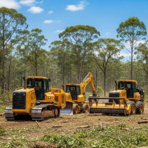
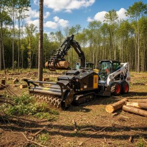
What Role Do Drones Play in AI-Driven Land Clearing Operations?
Drones supply the high-resolution spatial inputs that power AI models for land clearing, capturing RGB imagery, multispectral data, and LiDAR point clouds used for vegetation classification, volume estimation, and slope analysis. Drone data feeds photogrammetry and LiDAR processing pipelines to produce orthomosaics and DEMs, which AI models then analyze for cut-and-fill calculations and hazard detection. Because drones provide repeatable, timely surveys, they enable monitoring across project phases and support remote decision-making. The EAV table below summarizes drone sensor types and primary use-cases for site assessment.
Academic studies further underscore the transformative potential of integrating drone technology and GIS for accurate land assessment and operational efficiency.
Drones & GIS for Enhanced Land Assessment & Efficiency
This study investigates the integration of unmanned aerial vehicle (UAV), derived imagery into property valuation workflows in Trinidad and Tobago, with the objective of enhancing the spatial accuracy, timeliness, and operational efficiency of data used by the Valuation Division of the Ministry of Finance. The study assessed the limitations of traditional spatial datasets, including outdated aerial photography and medium-resolution satellite imagery, which have proven insufficient for identifying recent urban expansions and informal constructions. High-resolution orthophotos generated through drone surveys were then evaluated for their ability to improve feature detection and parcel boundary delineation. The updated datasets were integrated into a Geographic Information System (GIS)-enabled valuation ecosystem for facilitating field verification, property class
Integrating Drone Technology for Enhanced Property Valuation and GIS Assessments in Trinidad and Tobago, 2025
| Drone Sensor Type | Data Produced | Best Use-Case |
|---|---|---|
| RGB camera | High-res orthomosaic imagery | General mapping, visual client deliverables |
| Multispectral sensor | Vegetation indices (e.g., NDVI) | Vegetation health and species classification |
| LiDAR sensor | Dense point clouds, precise elevation | Volume calculations, slope and obstructions analysis |
This table clarifies sensor selection: choose RGB for documentation and client visuals, multispectral for vegetation classification and environmental planning, and LiDAR for high-precision volume and terrain modeling. Next, we detail practical data-capture workflows and processing best practices to ensure AI-ready inputs.
How Are Drones Used to Collect Data for AI Analysis?
Effective drone workflows follow four steps: planning, capture, processing, and inference. Planning defines flight altitude, overlap, and ground control, which directly affect model accuracy; capture executes missions to gather imagery or LiDAR; processing stitches images into orthomosaics and produces DEMs; inference runs AI models to extract volumes, vegetation classes, and risk flags. Attention to overlap and ground-reference points ensures geospatial accuracy, while consistent capture settings allow reliable change detection across repeated surveys.
Data quality is essential because AI models depend on consistent inputs—poorly planned flights or inconsistent lighting reduce model confidence. Following best practices during capture and processing produces dependable outputs that integrate seamlessly with estimating and safety workflows, which in turn improves bid accuracy and site management.
What Are the Safety and Efficiency Benefits of Drone-Assisted Land Clearing?
Drone-assisted surveying reduces crew exposure to hazardous terrain, allows remote verification of site conditions before mobilization, and speeds progress monitoring by delivering frequent, objective site snapshots. Remote monitoring means supervisors can verify completion of phases and measure volumes without boots-on-ground checks, reducing inspection time and increasing site oversight. Documented imagery also supports compliance and claims by preserving timestamped records of pre- and post-work conditions. Regulatory considerations remain important—licensed operators and compliance with local rules are prerequisites for safe operations.
By lowering the need for on-site human exposure and enabling rapid re-surveys after weather events or work phases, drones increase both safety and operational tempo. These advantages feed back into better scheduling, fewer unexpected delays, and stronger documentation for clients and regulators, setting the context for choosing software tools that can ingest and analyze drone data.
Which AI Tools Are Best Suited for Land Management Companies?
Selecting AI tools for land clearing depends on scale, data maturity, and integration needs; essential capabilities include robust data ingestion, automated quantity takeoffs, bid export, integrations with CRM/accounting, and user roles for collaboration. Small teams may prefer simple cloud platforms that automate orthomosaic ingestion and produce exportable line items, while larger firms benefit from GIS-integrated systems and bespoke ML models trained on internal job histories. Prioritize tools that provide transparent assumptions, allow back-testing against historical jobs, and support export formats for common estimating and accounting systems. The table below compares software categories by core feature and trade-offs.
| Software Category | Key Feature | Benefit / Limitation |
|---|---|---|
| Cloud estimator with AI | Automated takeoffs and bid export | Fast to adopt; may lack deep customization for enterprise workflows |
| GIS-integrated analytics | Advanced spatial analysis and overlays | High precision and control; requires GIS expertise |
| Custom ML models | Tailored cost prediction from historical jobs | Best-fit predictions; needs quality historical data and development resources |
This comparison helps match tool choice to organizational capacity: smaller contractors gain speed with cloud platforms, while larger firms can invest in GIS or custom models for marginal accuracy gains. The following checklist lists must-have and nice-to-have features to guide procurement.
What Features Should Land Management AI Software Include?
A prioritized feature checklist helps teams evaluate solutions by practical utility and integration potential. Must-have features include automated volume/quantity calculation, transparent line-item exports, and easy import of orthomosaics and LiDAR. Integration capabilities such as CRM, accounting, and fleet telematics sync estimates with sales and operations, while user roles and collaborative dashboards enable multiple stakeholders to review and approve bids. Nice-to-have features include erosion risk modeling, permit documentation exports, and scenario pricing engines for rapid what-if analyses.
- Automated quantity takeoffs: Essential for consistent, fast estimates.
- Exportable bid line-items: Enables direct import into accounting and invoicing systems.
- Integrations (CRM, telematics): Connects preconstruction with field operations.
These feature priorities set implementation scope and investment levels, and they lead naturally to the ways AI supports sustainability and compliance discussed next.
How Do AI Tools Support Sustainable and Compliant Land Clearing Practices?
AI supports sustainability and compliance by producing vegetation classification maps, erosion and runoff risk models, and automated permit-ready documentation that reduce environmental impact and streamline approvals. Vegetation classification helps avoid sensitive habitats and target invasive species removal, while elevation and slope models inform erosion-control placements before clearing begins. Automated documentation—timestamped orthomosaics, volumes, and mitigation plans—simplifies permit submissions and demonstrates due diligence to regulators and stakeholders.
By integrating environmental analytics into the estimating and planning workflow, AI helps contractors minimize disturbance, plan mitigation, and provide clear evidence for compliance. These outcomes not only reduce environmental risk but also enhance client trust and long-term competitiveness in markets where sustainability matters.